| Code | Date | Time | Duration | Location | Currency | Team of 10 Per Person | Team of 7 Per Person | Early Bird Fee Per Person | Normal Fee Per Person |
|---|---|---|---|---|---|---|---|---|---|
| COURSE CODE : PEA / SIOD /26 | 11 May 2026 | 8:00 PM Indian Time |
5 Days
|
Zoom Online
|
The Classes Will be from Monday to Friday Via Zoom Online. Daily Duration - 4 Hours Including QA & 2 Short breaks.
Boost your team's skills and your budget! Enjoy group discounts for collaborative learning. Send an inquiry to info@peassociations.com.
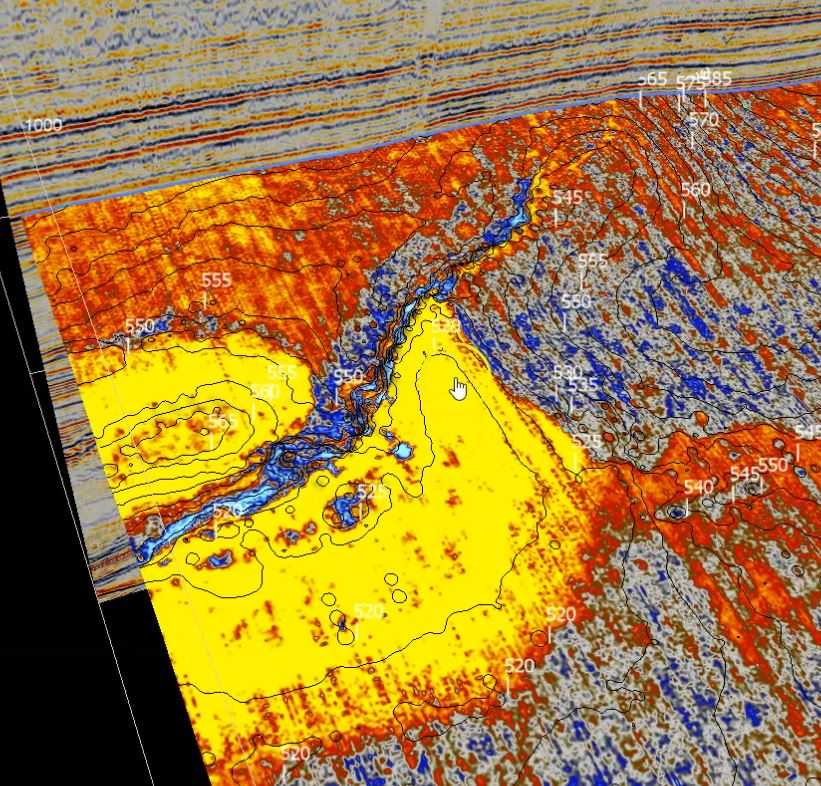
Practical Seismic Interpretation Using Software
Learn the essential skills of seismic interpretation with OpendTect, a powerful open-source software platform, designed for geoscientists and engineers in the oil and gas industry. This course provides practical knowledge and hands-on experience to make informed subsurface decisions.
Description
The "Seismic Interpretation with OpendTect" course is designed to provide participants with a comprehensive understanding of seismic data interpretation using OpendTect software. This program focuses on essential techniques and workflows that are fundamental for accurate subsurface analysis and exploration. Participants will gain practical skills to analyze seismic data, interpret geological structures, and enhance their decision-making capabilities in exploration and production. Whether you are a beginner or a professional looking to refine your skills, this course will guide you through the tools and features of OpendTect to maximize its capabilities.
Demo Class
Seismic interpretation plays a critical role in the oil and gas industry, enabling professionals to visualize and understand subsurface geological formations. OpendTect is a leading open-source software that provides geoscientists with the tools needed for advanced seismic analysis. This course is tailored to equip participants with the knowledge and skills to effectively utilize OpendTect for seismic interpretation, helping to drive accurate decision-making and reduce exploration risks.
This course will be delivered through a combination of interactive lectures, hands-on exercises, and real-world case studies. Participants will have the opportunity to work directly with OpendTect software in a practical learning environment, ensuring that they gain the skills needed for immediate application in their professional roles. The training will be guided by industry experts with extensive experience in seismic interpretation.
Day 1
1. Introduction
2. History of seismic studies
3. The
seismic method
3.1 Rock
properties
3.2 Wave
propagation, reflection, and refraction of
seismic waves, reflectivity, impedance
3.3 Data
acquisition – Land and Marine
4. Other
geophysical methods
4.1 Gravimetry
4.2 Magnetics
4.3 Electro
magnetics
5. Seismic
data processing overview
5.1 Conventional
pre-stack processing and CMP gathers
5.2 Post-stack
processing
5.3 Seismic
migration, velocity models.
6. Calibration
methods (well-tie)
6.1 Velocity
surveys
6.2 Sonic
logs
6.3 Synthetic
seismograms
6.4 Vertical
Seismic Profiles
Day 2
1. 2D and 3D
Seismic Data
1.1 Parameters,
visualization, polarity
1.2 Seismic
Data Libraries, public, private and licenses
1.3 Software
2. 2D and
3D interpretation techniques
2.1 hard and
soft events
2.2 Vertical
exaggeration
2.3 Horizontal
and Vertical slicing in 3D data
2.4 Seismic horizons – stratal interface, fluid contacts and non-geological horizons
3. Quantitative
interpretation geophysics
3.1 Acoustic
impedance and inversion
3.2 AVO and
pseudo-gradient
3.3 RMS
amplitude
3.4 Spectral
decomposition
3.5 Other
methods
Day 3
1. Fault
interpretation
1.1 Introduction to fault interpretation
2. Structural
styles
2.1 Rift
basins
2.2 Compressional
domains
2.3 Salt
tectonics
2.4 Strike-slip faults
3. Mapping
faults in 2D data
3.1 Faults in
each seismic line
3.2 Connecting
faults from different seismic lines
3.3 Building fault planes
4. Mapping
faults in 3D data
4.1 Mapping
faults in vertical and horizontal slices
4.2 Building fault planes
5. Structural
models
5.1 Building
a structural model
5.2 Visualization
5.3 Geometry,
kinetics, geodynamics
5.4 Palinspastic Reconstructions
Day 4
1. Stratigraphic
interpretation
1.1 Horizon
interpretation techniques
1.2 Horizon
attributes
1.3 Continuity
and lateral variations
1.4 Unconformities and stratal terminations
2. Seismic
facies
2.1 Carbonate
systems seismic facies
2.2 Siliciclastic
systems seismic facies
2.3 Gross depositional environments
3. Advanced stratigraphic
interpretation
3.1 Wheeler
diagrams
3.2 Seismic
sequence stratigraphy
Day 5
1. The
petroleum system elements and processes
1.1 Reservoir
1.2 Seal
1.3 Source
rock
1.4 Trap
1.5 Timing and migration
2. Mapping
hydrocarbon accumulations
2.1 Structural
traps
2.2 Stratigraphic
traps
2.3 Mixed traps
3. Volumetrics
3.1 Leads,
prospects, reserves, resources
3.2 Volumetric
calculation methods
3.3 P10, P50, P90 and mean
4. Risking
4.1 Risking
methods and software
4.2 Evaluation of CoS, PoS
4.3 Incorporation of Geological risk into economic evaluations
On successful completion of this training course, PEA Certificate will be awarded to the delegates


